Pictures of Mt Conness and White Mt
If you would like the original, high-resolution pictures, contact me
Notes of this trip | Back to California hikes | Pictures of the world
(If you have a slow-speed connection, click here for smaller pictures)

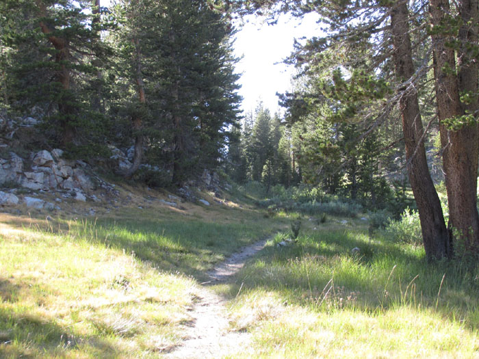
The trailhead at Tioga Lake
The trailhead at Tioga Lake

Mt Dana

The trailhead

The trailhead at Tioga Lake
Click here for the trailhead if you are starting from Saddlebag Lake (an easier but much less spectacular route!)

Up to Bennetville

Bennetville lake

Bennetville lake

Waterfall

Bennetville

Bennetville

Bennetville

Bennetville

Bennetville

Bennetville

Mt Dana

The trailhead at Junction camp

The trailhead at Junction camp
The trailhead at Junction camp

Bennetville

Bennetville

The trail

First lake

Second lake with Mt Dana

Second Lake

Second Lake

Entering the research area

Second lake

Second lake

Second lake

Flowers

Flowers

Flowers

Wildflowers

Wildflowers

Wildflowers

Wildflowers

Wildflowers

Wildflowers

Wildflowers

Mt Conness from Shell Lake

Mt Conness from Shell Lake

First creek crossing of the day

Shell Lake

Fourth lake

Creek

Hall Research Area

Hall Research Area

More bureaucracy

Entering the research area

Northwest is the White Mt

Northwest is the White Mt

Fantail Lake

Fantail Lake

Fantail Lake

Fantail Lake

Fantail Lake
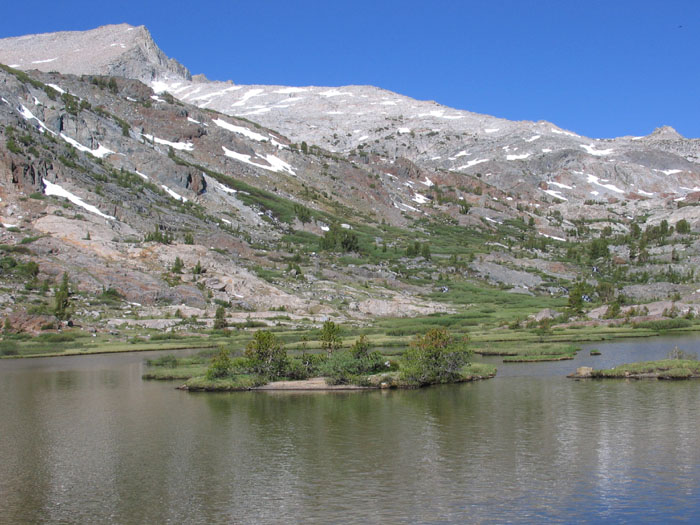
Fantail Lake

Fantail Lake

Fantail Lake and Mt Dana

Waterfall

End of the trail

Fantail Lake and Mt Dana

Fantail Lake

Up the gulch

Spuller Lake

Spuller Lake

Spuller Lake

Up the gulch

Finger Treble Lakes

Finger Treble Lakes

Finger Treble Lakes

Passing the Treble Lakes

Passing the Treble Lakes

Passing the Treble Lakes

Passing the Treble Lakes

Passing the Treble Lakes

Passing the Treble Lakes

Passing the Treble Lakes

Passing the Treble Lakes

Countless creeks to drink from

Passing the valley/meadow

Passing the valley/meadow

Passing the valley/meadow

Passing the valley/meadow

Passing the valley/meadow

Passing the valley/meadow

Passing the valley/meadow

Passing the valley/meadow

Passing the valley/meadow

Up the gulch

Up towards the bowl
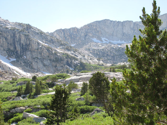
Up towards the bowl

Down below

Down below

Towards the bowl

Lots of water

Up towards the bowl

The use trail

Waterfall

Up towards the bowl

Looking down

Stay to the right

Left of the bowl, stay to the right

Left side of the bowl

Up the bowl
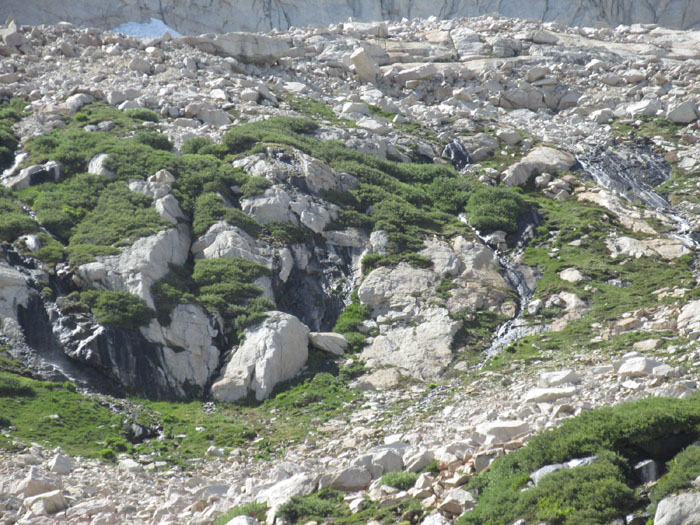
Waterfalls

Looking down

The use trail

Towards the pass

Towards the pass

Towards the pass

Looking down into the chute

Top of the bowl: to the right you go to Mt Conness, to the left White Mt

Top of the bowl

The last lake from the top of the bowl

Up the northeastern slope of White Mt

The bowl down below

Almost at the top of White Mt

White Mountain of Mt Conness

Summit register

Mt Conness

Mt Conness

Mt Conness and the bowl

The western route to Conness

The Young lakes

The plateau of White Mt

Mt Dana

Southwest

The way up from the north

Views southeast

Views southeast

Views southeast

Young Lakes and view west

View west

The ridge that extends from the White Mt to Young lakes

View south

Mt Conness and the bowl

Back to the top of the bowl and now going up Mt Conness (the summit is actually to the left, not visible yet)

Mt Dana

Mt Lyell and Mt McClure in the distance

View from the summit plateau

The summit plateau

The summit block

The first view of the north-eastern ridge

Towards the summit plateau

The concrete pillars where the USGS marker is

The summit block

The summit block

The first view of the west

Young Lake

Some exposure while climbing the summit block

Some exposure while climbing the summit block

Climbing rocks

The abyss to the right

The glacier to the right

Views west

Summit block

The west side of the glacier and Saddlebag Lake appear to the east

Summit block

Steps

The north-eastern ridge

A snow bank just before the summit

The summit

The summit

The register

Looking back down from the summit

The summit plateau from the summit block

The view southeast towards Mt Dana

The view south towards Mt Lyell

View of the Young Lakes and Ragged Peak

Saddlebag Lake to the east

The glacier

The view west

The view north (Panoramic 1)

The view north (Panoramic 2)

The view north (Panoramic 3)
View from the top of White Mountain that shows the routes to Mt Conness (video)
If starting from Saddlebag Lake:

The trail begins to the left of this building

and heads towards the dam

but stays lower than the dam

The trail is to the left of these rocky moraines

Mt Conness

The route
Back to California hikes
If you would like the original, high-resolution pictures, contact me